
08.05.2026.
More than 100 Hectares: Hardship and Victory on the Mountain
Understanding the Machine
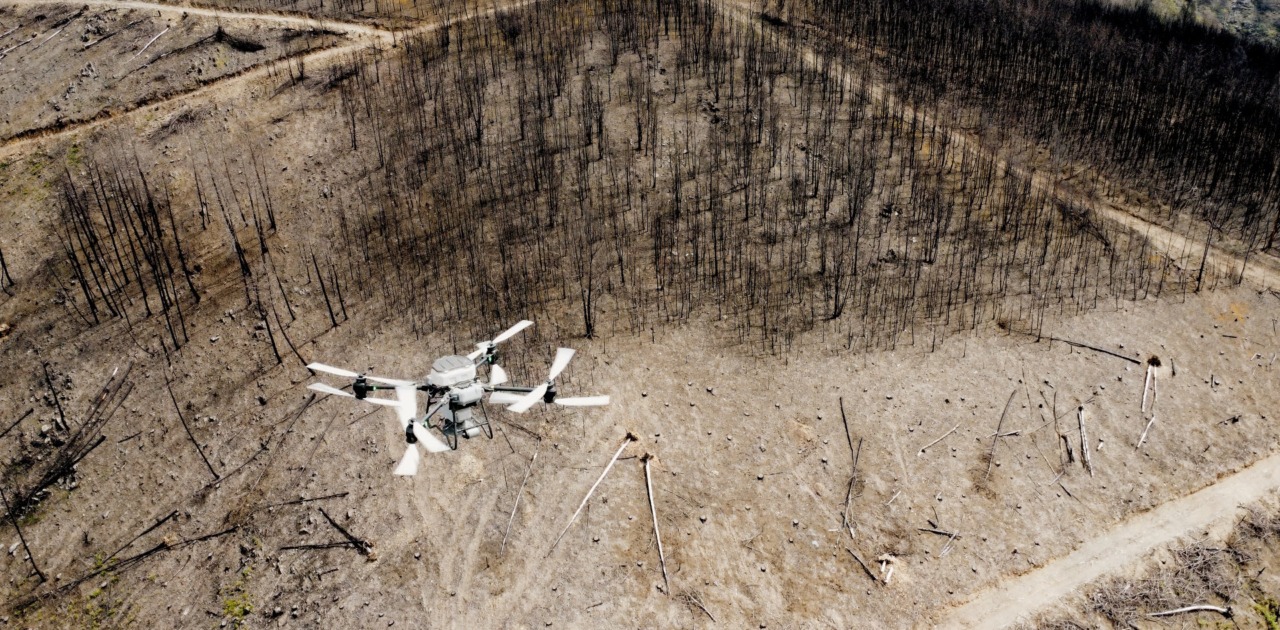
Seeding over a hundred hectares of burned mountain terrain is not simply a matter of flying a drone.
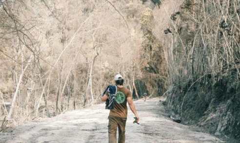
Taking on the Agras T50, our seeding drone, for the first time, while simultaneously covering more than a hundred hectares of charred, uneven ground, was an ambitious undertaking. The technical demands were significant on their own. But they existed alongside something more immediate: the physical reality of the work itself. Moving seed bags. Loading the drone. Rotating twelve-kilogram batteries. Walking across rocky, unstable terrain for hours at a stretch. It was as much a blast as a sweaty, physical effort.
The first and most important lesson: Agras T50 is as much your average drone, as a remote-controlled toy car is your average road vehicle. Many UAVs (Unmanned Aerial Vehicles) offer flight windows of ten to forty minutes. The T50 gives the operator approximately seven and this constraint changes everything. It takes planning to a whole new level, actually turning it into a safety requirement. There’s no flight in Silveira that hasn’t been extensively mapped, planned and prepared, period.
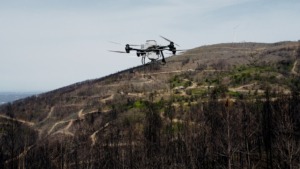
How far can the aircraft travel from its take-off point and still return with adequate battery reserve? What margins account for wind, distance, and terrain? What happens when multiple variables start working against you at the same time? The answer to these questions came from real-world experience. The drone can operate comfortably up to around 600 meters from take-off, provided line of sight is maintained. Battery planning became a discipline in itself: if the drone is operating 500 meters away, the return journey alone can consume 20–25% of remaining charge. The goal then was always to land well before power levels became a concern, both for the machine’s safety and to avoid unnecessary stress on the battery cells.
Key operating principle: Plan for the return journey first. At 500 meters distance, budget 20–25% of battery capacity for return-to-home before calculating how much payload run is achievable.
What the Obstacle Avoidance System Does Not Tell You
The second major learning concerned the T50’s obstacle avoidance system, specifically how it behaves when landing. When triggered, it can prevent the aircraft from touching down even when the ground below appears perfectly clear. On mountain terrain, this creates moments of genuine uncertainty. It led to broken propellers, unplanned landings, and a growing respect for how sensitive the system actually is.
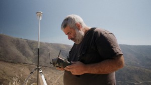
Equally critical was understanding the importance of the RTK — Real Time Kinematics — unit for GPS accuracy. Without reliable RTK positioning, precise low-altitude flight over complex terrain becomes far more difficult to manage safely. Once this became part of our standard operating procedure, a significant layer of risk was removed.
Watch the Feed, Not the Drone
The third lesson became something of a mantra.
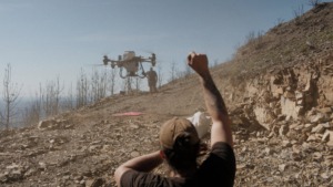
When flying the T50 over wooded mountain terrain, watching the aircraft directly can be actively misleading. Trees and ridgelines create the impression of imminent collision when no real hazard exists. The FPV controller feed tells a different story. One grounded in the aircraft’s actual position relative to its surroundings. Learning to trust the feed over instinct was the single most important shift in flying confidence across the entire operation.
The First Operation: Learning Without a Net
Previous experience with the Matrice 4E (a powerful, yet more conventional drone) for mapping provided a foundation, but it only went so far. Flying a heavy-lift seeding drone is a different discipline. In the absence of formal training, YouTube videos and direct experimentation filled the gaps, quite imperfectly. The result was three crash landings, each one a lesson in the drone’s highly sensitive obstacle avoidance system and the nuances that only become apparent through close contact with the machine.
The variables involved in each flight were more numerous than initially anticipated: terrain gradient, take-off location and access, wind and weather, potential radar deflections on landing, seeding distance, RTK signal strength, flight time management, route waypoint planning, and clearing jams in the seed hopper when they occurred. Each factor could, on its own, complicate an operation, but together they demanded a level of situational awareness that only came with time.
The Second Operation: Competence, Then Logistics
After formal training day with a professional trainer, the technical picture changed entirely. Knowing that expert support was available by phone made a difference that is difficult to overstate. Operations that had felt precarious became manageable. Procedures that had been improvised became systematic.
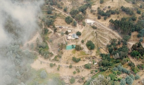
The challenges then shifted from the drone to the operation around it. A 250-kilogram generator does not load itself into a truck. Every morning, before a single flight took place, the team was already working: organizing equipment, designating landing sites, planning missions for the day’s terrain. Where needed, sites were machine-worked beforehand to create flat, stable surfaces for take-off and landing. Access roads that did not exist had to be made.
The preparation work was labour-intensive. But it made what followed possible:
101.65 Hectares seeded — roughly 140 football fields of burned land2,738 Kilograms of seed dispersed across terrain largely inaccessible on foot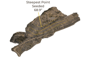
Much of that land could not have been reached by a ground crew within any practical timeframe. The slopes were unstable, the access limited, and the scale of coverage too great. The drone reached it in seven-minute windows, one payload at a time.
What the Technology Actually Demands
There is a version of drone seeding that looks, from the outside, like automation. The aircraft lifts off, covers the terrain, returns. Clean, efficient, almost effortless.
That version does not exist.
The T50 is a powerful machine. But every flight it completes is supported by people on the ground carrying 25-kilogram seed bags, rotating batteries, maintaining the generator, and packing everything into a truck before first light. What this operation ultimately demonstrated is that aerial drone seeding at scale is a logistics challenge as much as a technical one. The aircraft is the most visible part of the system, but not always the most demanding. If there is one thing that crash landings and broken propellers reliably teach, it is that technology performs in proportion to the discipline and care placed around it. The drone did not remove the hard work, but it allowed us to reach a scale we didn’t think possible in our wildest dreams.
And we’re only getting started!

23/03/2026
How Drones are Transforming Regeneration
08/10/2025
From a Humble Storage to an Off-Grid Basecamp
Learn how we work off-grid as well as the challenges and benefits this way of life brings!
27/08/2025
Serra da Lousã Burned. We Resisted.
On August 14th, at the peak of a brutal heatwave, a massive fire swept through the mountains of Lousã. In just a few days, over 3,500 hectares of mountain forest were reduced to ash. Our land was no exception.